GIS Work
Projects involving GIS/Remote Sensing techniques and methods

Hurricane and Storm Road Risk Visualization
(Python)
Combining Python and GIS methods to visualize NOAA hurricane data
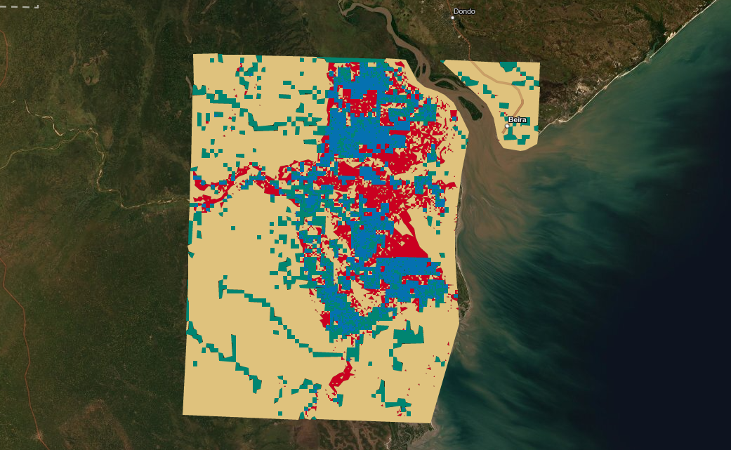
Hydrological Flooding Model Assessment
(ArcGIS API for Javascript)
Assessment of Hydrological Flooding Models Using Raster Analysis and Map Algebra
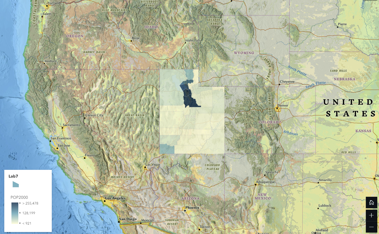
Utah Population Change Mapping (ArcGIS StoryMaps)
Using computer cartography to visualize population changes in the State of Utah

Remote Sensing of Land Changes in the D.C. Region (ENVI)
Using various remote sensing techniques to assess Land Changes in the D.C. Area